In this article, you'll find detailed overview of the features, included in DMXzone Google Maps 2. We'll take a closer look on the customization options and also the great integration with HTML5 Data Bindings, DMXzone Database Connector PHP/ASP and HTML5 Geo Location.
Features
Integration with HTML5 Data Bindings
Full integration with HTML5 Data Bindings and DMXzone Database Connector
Choose addresses and Geo locations from any feed but also from HTML5 Data Bindings data source with the help of DMXzone Database Connector PHP/ASP.
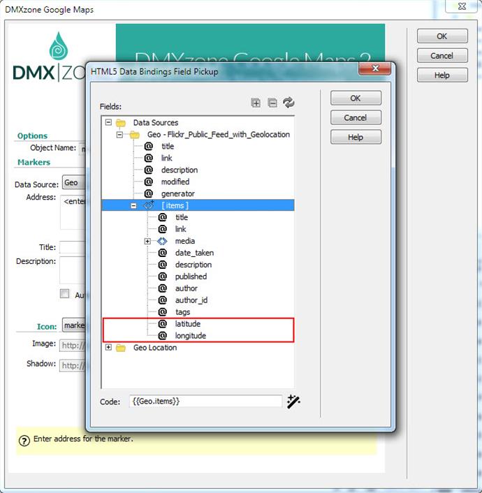
Automatic markers updates with HTML5 Data Bindings
Now when you bind your markers to a HTML5 Data Binding and the data refreshes then all the markers get updated automatically.
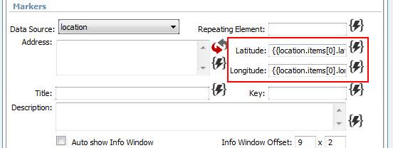
Automatic map center positioning with HTML5 Data Bindings
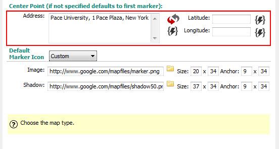
When you use a data binding as map center address, then when its data changes the map is automatically centered to the new address.
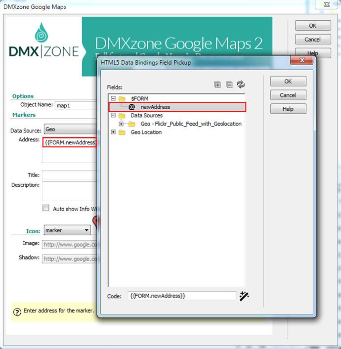
Dynamic tracking and positioning with HTML5 Geo Location
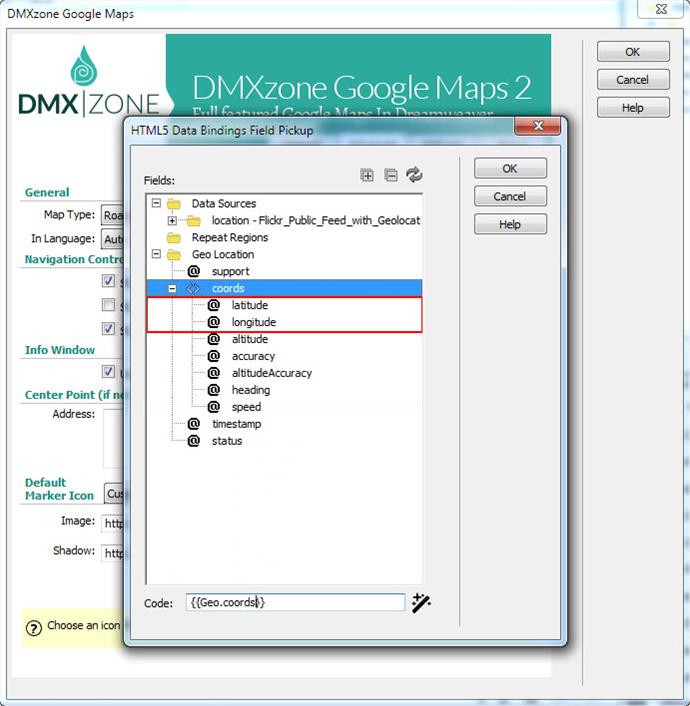
Using HTML5 Geo Location picker you can dynamically adjust the center point of the map on which the viewport will be centered.
Customize the Map
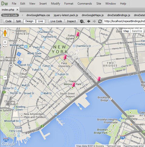
Real-time preview in Dreamweaver
You can see a preview of your Google Maps directly in Dreamweaver Live View.
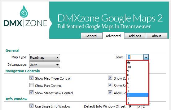
Zoomable Maps
Define the resolution of the current view from 1(the lowest zoom level, in which the entire world can be seen on one map) to 19. You can also choose "fit" to make the map auto determine the best zoom level so that all markers are visible.
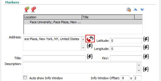
Convert address to Geo location
Convert a street addresses or other locations (ZIP codes, postal codes, city & state, airport IATA/ICAO codes, etc.) to latitude and longitude, which can be entered into a GPS device or geographical software. Geo Location is always preferred due to limits in Google API when decoding multiple addresses at once.
Position marker by latitude/longitude as well as by its address
Enter the latitude and longitude for places that can not be entered by address or name.
Add title and description for you markers
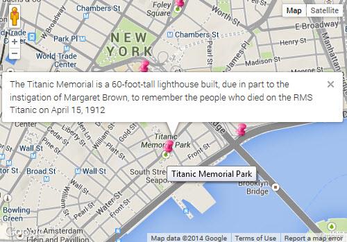
Full support for rich HTML info windows.
Street View
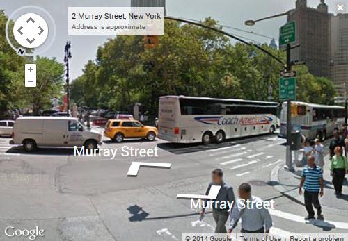
Enable the Street view to explore places around the world through 360-degree street-level imagery.
Fully controllable by behaviors
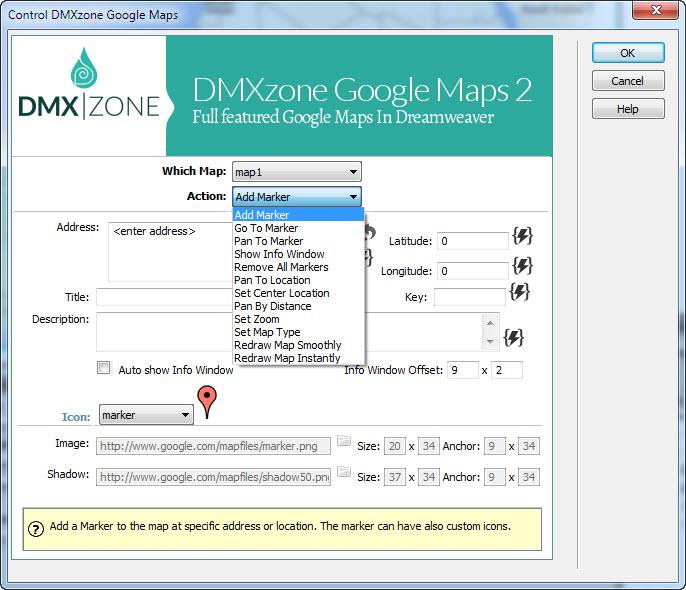
The available actions are: add/remove marker, pan to location, set center location, pan by distance, set zoom or set map type, and more.
 Lubov has been with DMXzone for 8 years now, contributing to the Content and Sales departments. She is bringing high quality content in the form of daily blog updates, reviews, tutorials, news, newsletters,update emails and extensions' manuals. If you have a product that needs publicity or any other questions about the entire DMXzone community, she is the one you can contact.
See All Postings From Lubov Cholakova >>
 Lubov has been with DMXzone for 8 years now, contributing to the Content and Sales departments. She is bringing high quality content in the form of daily blog updates, reviews, tutorials, news, newsletters,update emails and extensions' manuals. If you have a product that needs publicity or any other questions about the entire DMXzone community, she is the one you can contact.


Comments
Be the first to write a comment
You must me logged in to write a comment.